


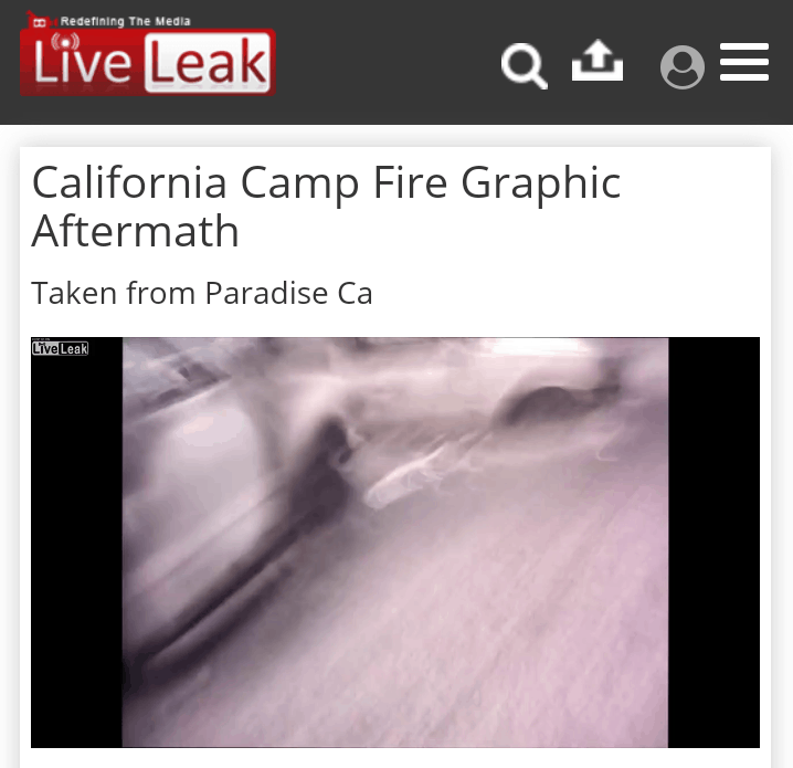
The evidence is overwhelming that the Paradise fire was a DEW / Smart Meter event, but directly preceding the fire, satellite images show a massive explosion that appears to have come out of the ground. Researcher/author Craig Patin (article below) believes that DEW and Smart Meters were used after that triggering event.
“There are testimonies from residents that there were loud popping noises and sudden booms that weren’t like explosions. This is reminiscent of both of those (DEW/SM) being used. But what started the fire was something blowing out of the ground, not just an arc from a power line,” he said.
Craig believes that that “something” may have been spiritually invoked. While there is no evidence to definitively establish this, Craig’s blog, HiddenInTheCrag.com, offers insight into the many coded headlines and public rituals we’re witnessing today. These are things that, as Christians, we should all be aware of.
“People claimed even the fires were smart and literally chasing people. They were calling them “demon embers,” he said.
The truth about DEW and Smart Meters is being disclosed to the public. Even those who have not wanted to entertain “conspiracy theories” in the past are listening now. But with secret societies and their social engineering, the truth always lies in deeper layers than what they allow to be revealed. Those layers are unending and unfathomably evil. Chaos Magick, “Christian Gnosticism,” the supernatural has been obscured from even the Christian public’s view, while occultists know exactly how real it is. It is where they operate.
Betsy, The Captain and the Eye of the Fire (Part 1)
by Craig Patin
“They are using their light to bring everything to ashes. Order out of chaos”
I started to look at some articles from the paradise fire the last few days and see if the information was still lining up. Obviously in these types of stories everything changes on a daily basis. With that said, the stories have changed now.
The “Story”
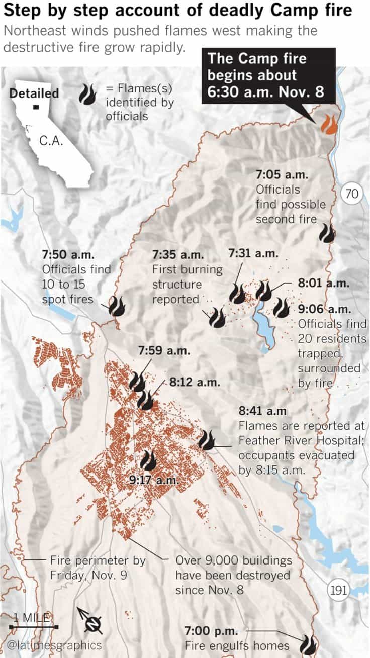
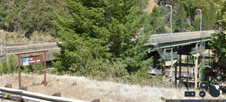
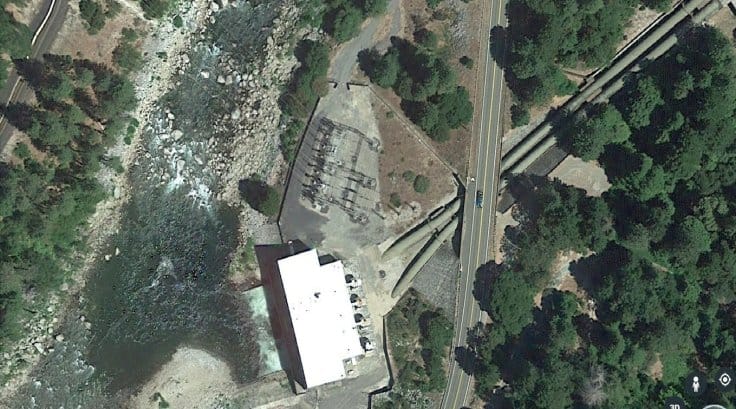
The original story is that this fire started above Paradise at a place called Campfire and this is why they actually called it the campfire. It was not associated with somebody having a campfire and a fire starting. The original report I read said the fire started at a junction where Campfire Creek, Feather Creek and I-70 are. Now I’m starting to read a story from a fire captain from the forestry service name McKenzie, that this fire actually started at PG&E’s Poe Dam station from a power line on the other side of Feather River on the rocky side of the mountain from a tiny brush fire.
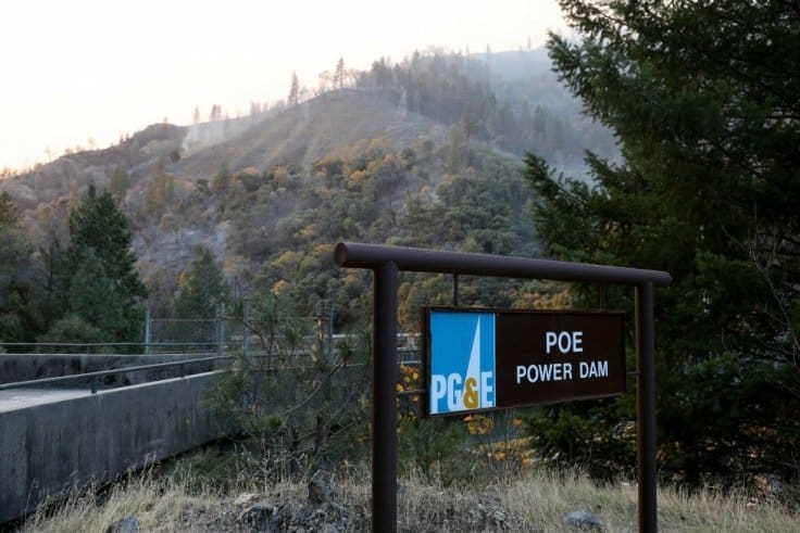
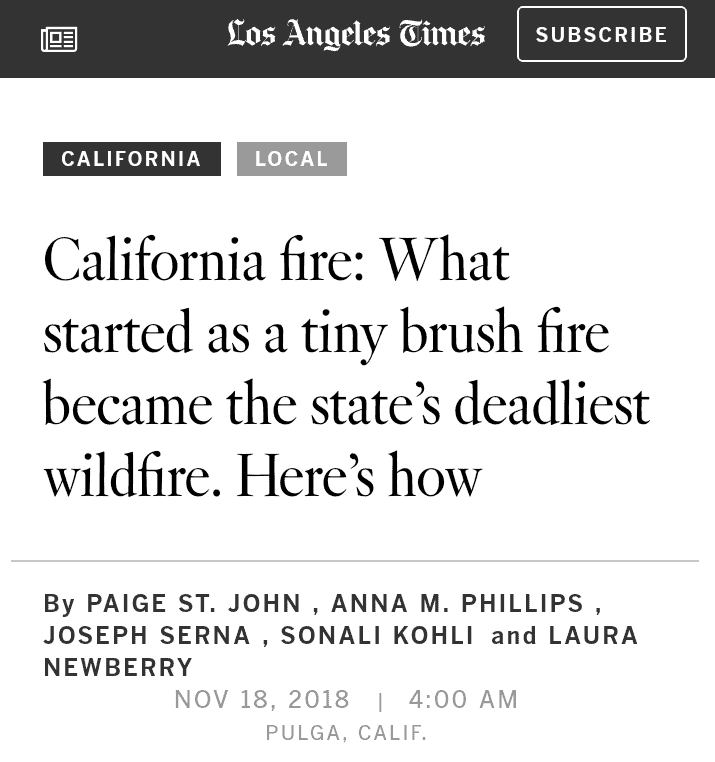
Poe Dam. If you look to the left of the 2nd picture, you will see the rocky section where the lines arched.
“From his station bunk at the head of Jarbo Gap, Capt. Matt McKenzie of the California Department of Forestry and Fire Protection woke to the sound of pine needles pelting the roof.
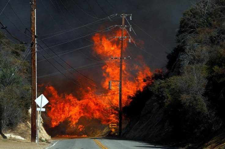
At 6:15 a.m., a Pacific Gas & Electric Co. high-voltage line near the Poe Dam generating station six miles away malfunctioned. A report of fire came at 6:29. Fifteen minutes later, McKenzie stood at the dam looking helplessly across the river canyon at a 10-acre fire on the rock slope above. He had no way to reach it. Its unpaved access route, Camp Creek Road, clung to the mountain so precariously that rock slides threatened to erase it. The last time he put a heavy wildland engine on the crumbling grade, it took an hour to creep a mile, mirrors folded in, a man walking beside each wheel to watch for collapse. It would be a death sentence to send a crew out there in a fire. California’s professional wildfire strike forces make a regular practice of killing small grass fires — stomping thousands into anonymity each year. But this one was being lashed by a canyon vortex locals call the Jarbo wind.” (https://www.latimes.com/local/california/la-me-camp-fire-tictoc-20181118-story.html?outputType=amp)
Jarbo Gap is around 6 miles South from where everything took place as you can see the fire trucks in the picture below. The article states that the Jarbo winds had everything to do with it in the canyon and they said the winds were 55 mph at the time. Jarbo in Arabic means strong, so it was strong winds, etymologically speaking. I’ll get back to this strong wind spirit vortex when I talk about Betsy, the face of Pulag.
They claimed the fire started there and then spread out and first went to Pulag, then to Concow, then over to Maglia, then headed to Paradise. They said it was from a power line arching and causing the fire. Evidently Betsey Ann Cowley (reminded me of Crowley for some reason) had complained about these power lines because it just so happened to be on her property. I’ll get back to her in a minute. So, this was now the story they were sticking to. To me personally, I don’t see how a ground fire can cause this sort of damage in such little time and incinerate not only houses, but people and animals.
My Theory
My theory from the beginning was that a directed every weapon started this initially and that caused not only the ground fire but a power surge to the nearby cities that were affected.
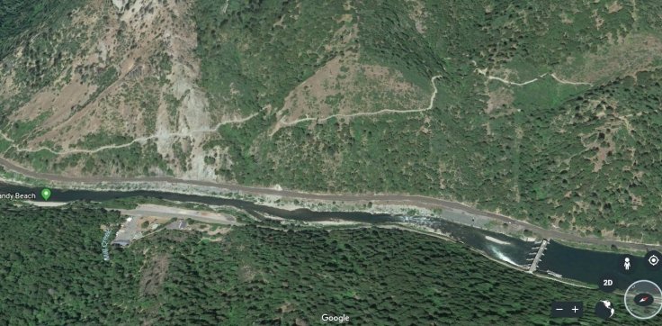
I traced the power lines on Google Earth and these lines from the hydro station 2 miles above Poe Dam lead South alongside the river sweep underneath Paradise to the West and then back North to Chico, which feeds Paradise and the outlying communities. I believe this fire was threefold. It was started by a DEW laser at the hydro station 2 miles North of the Poe Dam, that surged power near the Poe Dam that started the grass fire.
This is the hydro station where all the power comes from. I believe this is where it started with DEW hitting it. Down river you can see Poe Dam. That is a 2 mile difference. I70 is the road to the left of Feather River and Camp Creek is directly in the middle of the picture going up the mountain. This is the area they original said it started.
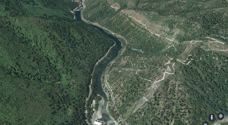
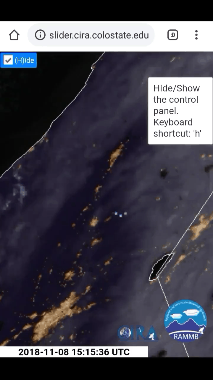
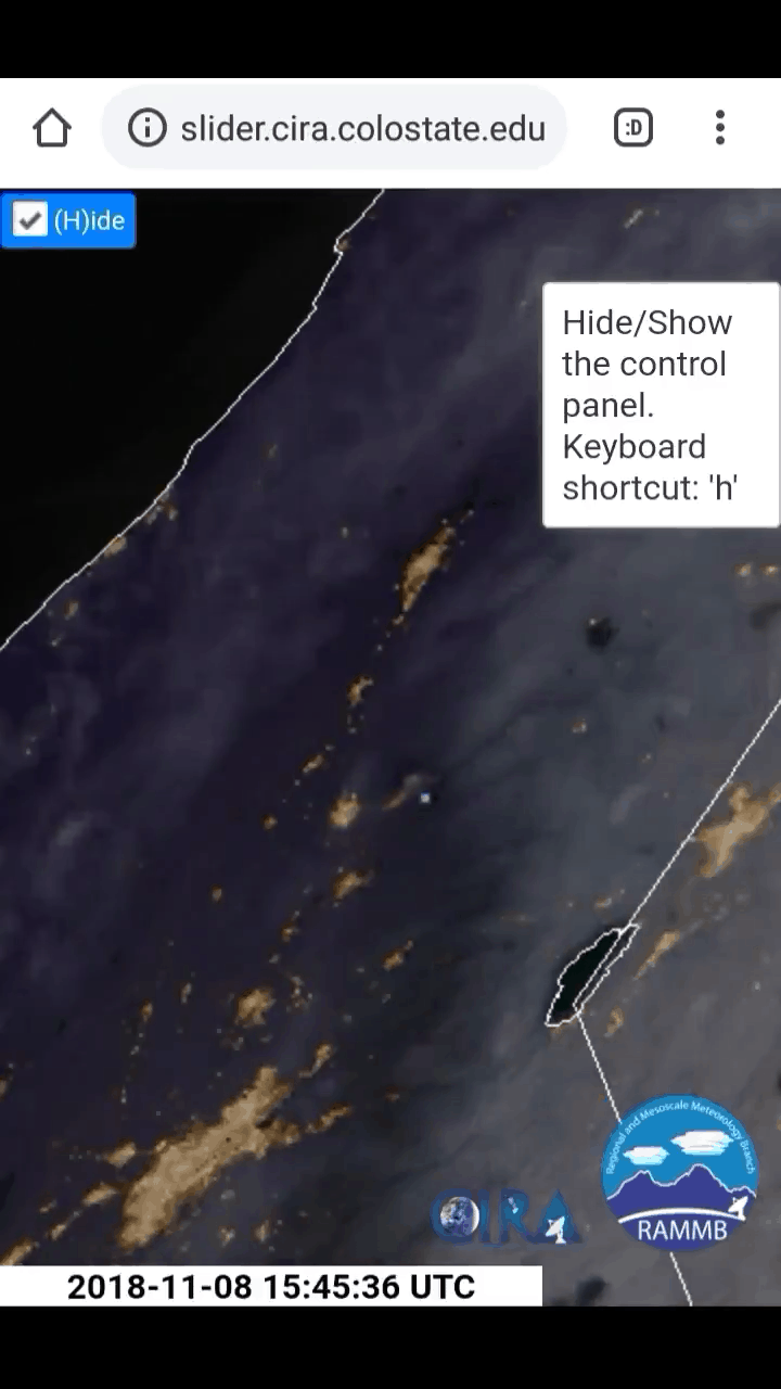
This Feather River, Camp Creek and I70 coordinates were the original setting of where they said the fire actually started and I believe this is true. I believe the anomaly that we saw from the Colorado State satellite video was of a DEW laser that was showing up on the imagery. We saw these anomalies later that night of the 8th also.
The power then surged through the line to nearby towns setting off a chain of explosions and fires in houses and buildings via Smart Meters. Now from what I can tell is that the power lines run to Chico first and then to that area on the mountain. Now what is interesting about the Chico connection to Smart Meters is that they have had many problems with these meters in the past. Deborah Tavares has focused in on this area of the state to fight the electric companies and their smart meters.
Chico’s Smart Dumb Meters
Chico is where countless meters have exploded on houses due to downed line surges. This isn’t a secret. So I find it strange that Chico’s problems could now be Paradise’s problem. This connection affirms my belief that Smart Meters are what incinerated these houses and buildings in part with the actual ground fire itself.
The smartest fires around.
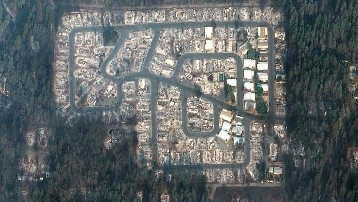
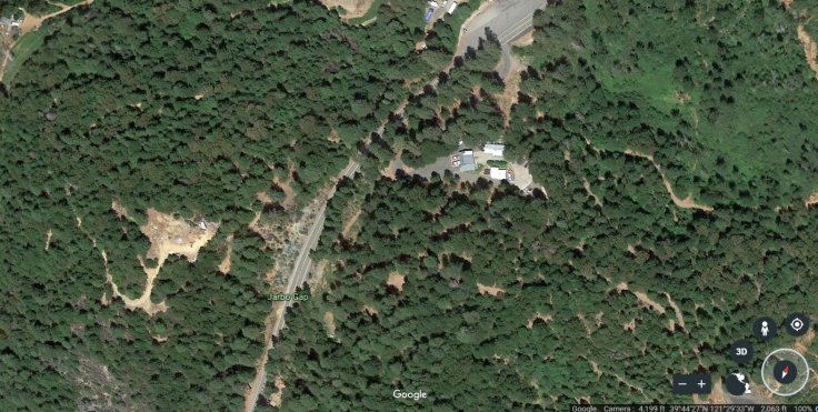
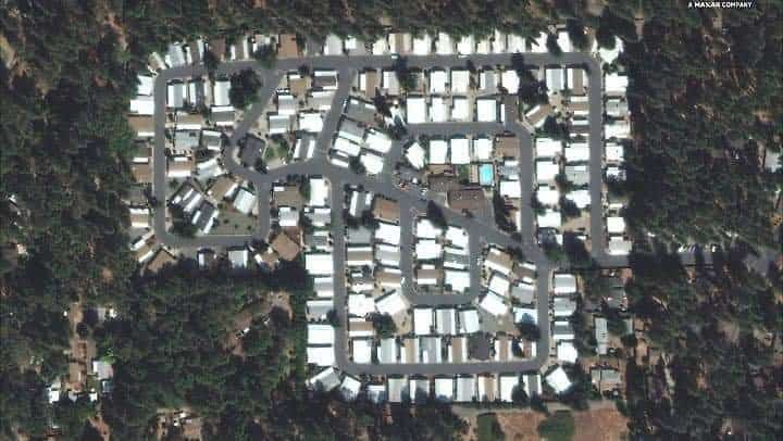
Also take note that these structure fires burned from the inside out not the other way around. When looking at the first pictures, you will see walls still standing while the houses are gutted and consumed by fire from the inside.
I believe the Smart Meters in conjunction with the lasers is why everything in incinerated to greyish white ashes and bodies were literally cremated in some cases. There is nothing blackened there like you would see with a ground fire.
Discrepancies
I first want to bring up a testimony from a woman named Cheryl Kirby who was from Paradise. I don’t know this woman from Adam, but I’m just giving you her testimony of what transpired up to November 8th. She claims 4 weeks prior to the fire, a strong wind came in that blew for around 7 minutes. It left a residue on her windows that was like a snowy white substance. She claimed it was Morgellons. She believes it could’ve been used as an accelerant for the fires. Two weeks later she and other Paradise residents saw a private helicopter circling Paradise for an undisclosed amount of time. They thought that it was odd, to say the least, but thought nothing of it at the time. After the fact, they now believe the suits inside it were associated to some sort of land grab for Paradise. On Monday the 5th, Kirby and other residents started to receive emails from PG&E stating that there would be a planned power outage during that week due to fire dangers. Either on that same evening, or Tuesday the 6th, they started to receive calls from PG&E (I’m assuming automated) claiming that there was a fire warning for a fire on Thursday, November 8th. They claim they got more than one call stating this.
On the day (8th) of the fire, Kirby said she went out to get gas at around 7am and noticed smoke to the North of her that she thought was Maglia. She confirmed from other residents that it was 45 minutes away at Concow. Concow was near Pulga, where the fire had originally started. She said she went home to spray her property and house with water and started noticing embers coming in from a strong wind. She also said that a black tar substance was in the air falling to the ground. Now to me, this is interesting. What was the black tar like substance? She says by 11am she was evacuating Paradise, and as she was, she noticed that all of the power poles going down their main street, Skyway, were on fire. It wasn’t the entire pole but it was the boxes where internet, cable and phone was located. This is more than likely where the 5G was housed.

I did confirm everything this lady said through separate sources and a “New Age” site summed up what this woman said that sounds identical to what I just wrote (I found the site after the fact: http://www.starshipearththebigpicture.com/2018/11/17/california-residents-trapped-and-killed-when-fires-were-started-all-around-the-towns-perimeter-videos/?fbclid=IwAR2wUgNXTOj4dp7jkEL1uGaCiz5Rh9L2GiHOrXEQvjnHJBBs8lIzyUL-pYo).
I also know from a first hand account from my mom’s friend in Paradise, that she was personally told over Summer to be ready to leave her house due to a bad fire in the near future. Evidently they had told residents to have bags ready if they needed to leave their houses due to a fire. They were forewarning these people of Paradise and like the lady mentioned above, they were told about the fire the week of. I actually did come across PG&E letters to residents of these fire warnings.
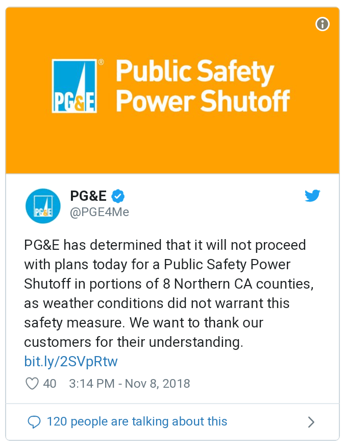
What is so crazy, is that after all of these emails and phone calls about fire danger and warnings from PG&E, they kept the power on even after the fire.
“Nearly all of PG&E’s fire danger thresholds had been met — such as wind speeds and the fire-alert declaration — to warrant a preemptive shut down of power for the second time in the utility’s history. But, despite 48 hours of warnings to residents in Butte and eight other counties that power could be interrupted Thursday morning, PG&E decided to keep the electricity flowing…In a tweet at 3:14 p.m. Nov. 8, almost nine hours after the Camp Fire roared to life, PG&E announced it would not conduct a Public Safety Power Shutoff anywhere “as weather conditions did not warrant this safety measure.”
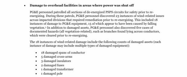
“On Tuesday, Nov. 6, with a forecast of high winds and low humidity expected two days later, PG&E alerted the public that, as a precautionary measure, power might be interrupted in certain Northern California counties, including Butte County. Over the next 48 hours, the utility tweeted out 17 different warnings of an impending Nov. 8 morning shut-off. It even tweeted out a warning at 7:56 a.m. Thursday, more than an hour after the Camp Fire was reported, that the power interruption was still an option, before calling it off at 3 p.m. that afternoon, hours after the Camp Fire swept through Paradise.
“Paradise Mayor Jody Jones said she received the warning notices from PG&E last week and sensed frustration in her community of the potential inconvenience.
“I saw quite a few people on social media with negative comments about it, but what do you expect?” she said. “You can hold them liable for the fires, but they can’t do anything about it?” (https://www-chicoer-com.cdn.ampproject.org/v/s/www.chicoer.com/2018/11/18/why-didnt-pge-shut-down-power-in-advance-of-deadly-camp-fire-heres-the-data/amp/?amp_js_v=a2&_gsa=1&usqp=mq331AQHCAFYAYABAQ%3D%3D#aoh=15429516428980&_ct=1542952028038&referrer=https%3A%2F%2Fwww.google.com&_tf=From%20%251%24s)
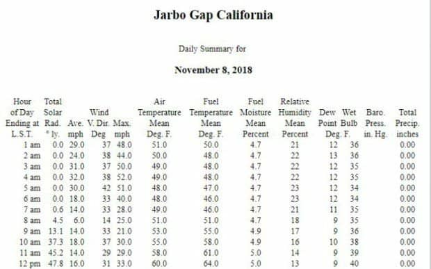
So what is really going on here? Warnings of a fire in the future and threats of them during power off, then a fire sweeps through and nothing. They kept the power on after the fire was going through Paradise. Why? Maybe because part of this fire was due to Smart Meters needing to do their job? You would honestly think that PG&E would turn off gas lines to stop from explosions from happening, but they didn’t. It doesn’t stop people thinking that PG&E didn’t conspire and was inviting this fire to burn the town of 26,000 down to ashes. They also mention the winds in this fire and how bad they were blowing. What is strange is that these gusts, according to radar satellites, were coming North headed East. Now if you look at how the smoke expanded then you will see it going West and actually one stream of smoke went South. Why is that? Look at their chart below and it will show you the wind average and gusts. Nothing here is making sense.


They warn of fires then don’t shut any electric or gas off. There are also reports that they wouldn’t let residents evacuate. And now the reports of not letting residents back in, but they want their DNA in order to find their family members. Are we living in the twilight zone?
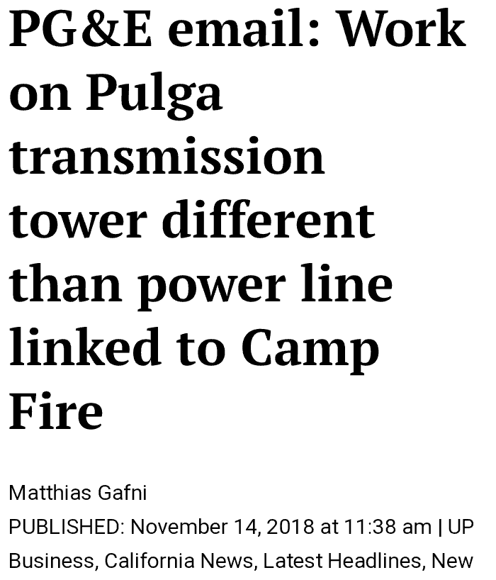
They were burning down Paradise for a reason and I’m am almost positive that this is/was a ritual. I’ll explain in a minute why I believe that. The L.A. Time’s even reported about these discrepencies. One other thing I want to point out is that PG&E now claims that the lines they were checking on Cowleys land weren’t the lines that caught fire. Are you keeping up with all the lies? You can read it here.
Incident Reports
(My comments in italics)
PG&E stated in their incident report that there was some issues at the time of the fire and their substations. I don’t know if that’s the hydro station above Pulga or the damn itself. My guess it the former. I want you to see these quotes from this article below.
“Just what the problem might have been is unclear, but firefighter radio transmissions reviewed by Bay Area News Group and an alert sent to state regulators indicate a transmission line created a hazard about 15 minutes before the blaze was first reported. Firefighters found downed power lines and a fast-moving fire beneath the high-tension wires when they arrived to the fire’s origin about a mile northeast of Pulga by the dam. (Something happened 15 minutes before the fire. We know that according to this article.)
State regulators have launched investigations into California’s two largest utility companies after both PG&E and Southern California Edison Company reported that their electrical infrastructure suffered malfunctions near ground zero of two deadly blazes raging across the north and south of the state. (The electrical infrastructure suffered malfunctions. What does that actually mean? They aren’t saying what caused it but are saying something happened prior to the fires.)
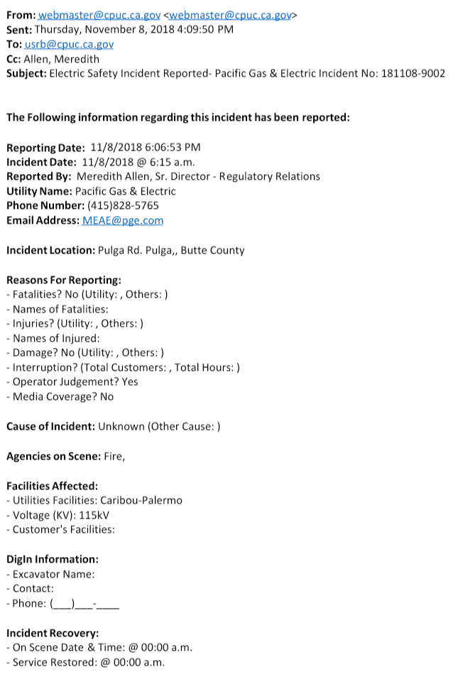
On Friday, PG&E disclosed in a filing to the CPUC that it had detected an outage on a transmission line in Butte County, occurring about 15 minutes before the Camp Fire was first reported and in the same location Cal Fire pinpointed as the origin. The utility said a subsequent aerial inspection detected damage to a transmission tower on that same transmission line a mile northeast of the town of Pulga “in the area of the Camp Fire.” (So once again, they are claiming something happened 15 minutes before the fire at the power lines across from Poe Dam that was 1 mile from Pulga. But did it originate at the hydro station up river 2 miles like I suspect? Or 1 mile from Pulga? Was it a DEW weapon that caused damage to their infrastructure or something else? Maybe something spiritual was unleashed? I’ll get to that in a second.)
That is the approximate location of Poe Dam where initial radio transmissions of the fire — which has killed at least 29 people and destroyed more than 6,000 structures — indicate that a damaged transmission line was found by firefighters who discovered the initial fire beneath the high tension wires. On Monday, guards blocked access to the road beyond her property preventing anyone from continuing the final 3/4-mile to the transformer towers. (So whatever it was, it had been kept secured by guards. Ironically at this point (11/24/18), Paradise is now under lock and key and I can tell you for a fact that residents are not able to go check their houses. My mom has childhood friends there and she confirmed this today (11/24/18). I also saw a report that the military is there and the town is on lockdown. On a good note, my mom’s friend didn’t lose her house to the fire. Sure was fortunate.)
On Thursday, SoCal Edison issued an alert to the CPUC that a substation circuit near the origin of the Woolsey Fire in Southern California “relayed,” or sensed a disturbance on the circuit, just two minutes before Cal Fire said that devastating fire began. (So as this story goes on they give us more and more, Woolsey fire in SoCal also had a disturbance on their circuit. Ironically and coincidentally, both fires on the same day had problems minutes before the fires and they both have the same m.o.)
“Preliminary information indicates the Woolsey Fire was reported at approximately 2:24 p.m.,” the company reported. “Our information reflects the Big Rock 16 kV circuit out of Chatsworth Substation relayed at 2:22 p.m.” (https://www.timesheraldonline.com/2018/11/12/state-regulators-investigating-pge-socal-edison-for-roles-in-deadly-camp-woolsey-fires/)
So what can I say? They have admitted to a disturbance in the force, I mean circuits and this was minutes from each fire. So we know for a fact that something interfered with the circuitry whether it was from a weapon in the form of a laser set off by man or maybe it is something entirely different behind all of this? Maybe it was AI doing their take over? You think that this AI theory is far fetched? I wrote about it all last year on this blog and it makes more sense than what a lot of people have been saying in regards to AI.
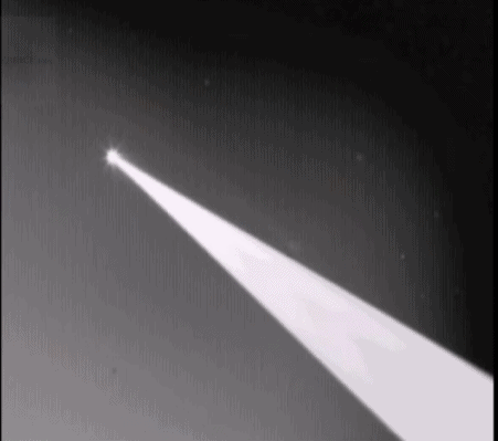
Lasers from a 747
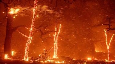
Now the talk around the internet is that DEW were without a doubt being used during the fires at Paradise. We saw this with Santa Rosa and the Ventura fire of 2017, the fires in Greece this last year and both recent Woolsey and Paradise fires. Below is what people claim as proof that these lasers are the reason as to why.
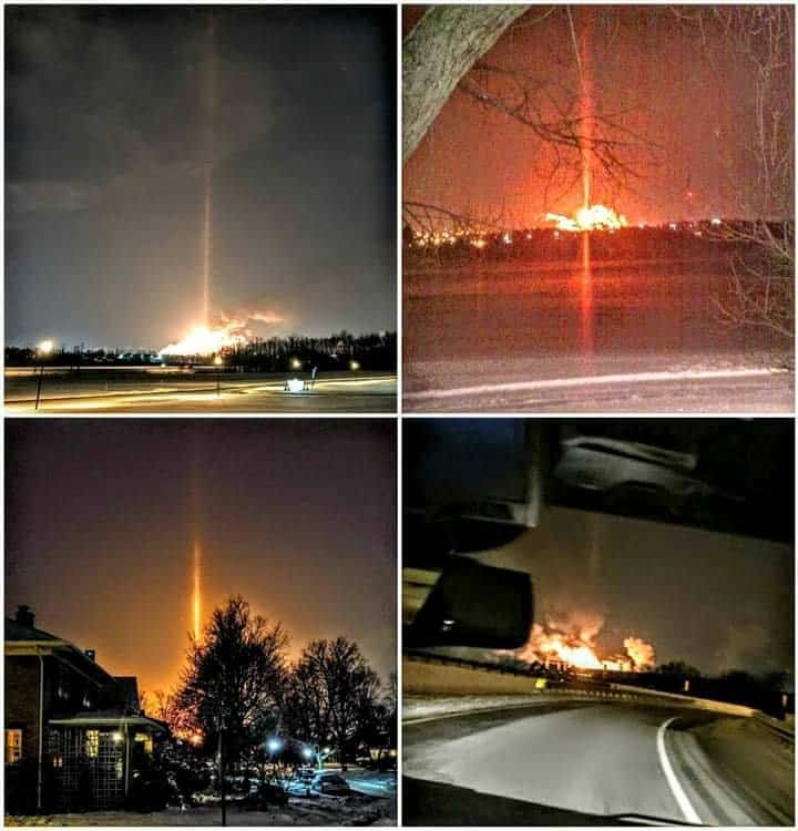
The problem I have with these images is that I personally don’t know where these images came from and in a few cases they may be lens flares or firenados. With that said, I do think a few of these images are in fact lasers, but I need to know where and when these images were taken. I would need a source but I’m not denying that they [could be] fake. Are they from any of the fires I mentioned above? Or are they stock military photos?
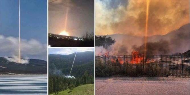
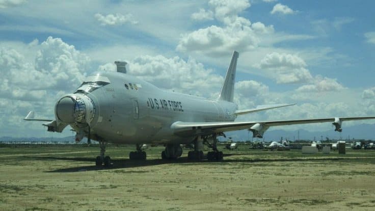
Most people don’t actually realize that some lasers are infrared and can’t be seen. It’s sometimes not as dramatic as something like a Star Wars light saber. The theory is that these lasers are being “shot” from a Boeing 747 called a YAL-7. I don’t deny this because I actually wrote about this in dealing with the Santa Rosa fires.

The interesting thing about this YAL-7 is that these were made to be used in the Middle East. In 2015 they talked of how they were going to “resurrect” this type of weapon. Odd language to use for a weapon that will turn something to ashes through a light. You can almost see the symbolism there of what is being said. The Pheonix will rise out of their ashes, one way or another.
“The Airborne Laser program can be tracked back to the Reagan years, and after billions in development dollars were spent and a custom-built 747 prototype was built, what was to be a super-weapon that could shoot down ballistic missiles over their countries of origination turned out to be a super-flop. Now, with the drastic advances in laser capabilities over the last half decade, the Defense Department wants to resurrect the airborne laser, albeit in a very different form. Although the YAL-1 was an impressive looking weapon system, and on paper it seemed like an amazing capability to have, it never came near to achieving its design requirements and it was plagued with problems during testing.
In the end, it would have had to orbit too close to potential enemy ballistic missile launch sites to be effective, and even if greater effective range could have been achieved, a fleet of these huge aircraft orbiting continuously near enemy countries would have been prohibitively expensive.
Secretary of Defense Robert Gates said of the program:
“I don’t know anybody at the Department of Defense, Mr. Tiahrt, who thinks that this program should, or would, ever be operationally deployed. The reality is that you would need a laser something like 20 to 30 times more powerful than the chemical laser in the plane right now to be able to get any distance from the launch site to fire… So, right now the ABL would have to orbit inside the borders of Iran in order to be able to try and use its laser to shoot down that missile in the boost phase. And if you were to operationalize this you would be looking at 10 to 20 747s, at a billion and a half dollars apiece, and $100 million a year to operate. And there’s nobody in uniform that I know who believes that this is a workable concept.”

Now you can see that this airliner was in fact dreamed up prior to the Reagan years but there was doubt in it from the very beginning. One of the reasons as to why they claimed they couldn’t use it was because of being behind enemy lines. It was too risky. But, this didn’t stop the Air Force from getting them. So the question is this, were they all grounded at Abe, have they been used yet? Some people would say yes, at these California fires. I can see them using these but they aren’t exactly trying to hide them in plain sight now are they. They even state in the article that they are gong to make something smaller in the future in the size of a drone. These 747 lasers use the chemical in the plane, so they only use so much at a time.
“Now with the advancements in solid-state lasers, which are much smaller than their chemical cousins, and with development programs that are seeking to mount them on everything from AC-130 gunships to fighter aircraft, the Pentagon is looking at procuring a new airborne laser. This one would be unmanned and fly at much higher altitudes than its 747 grandfather. A new Airborne Laser’s core mission would still remain largely the same as its predecessor: shooting down ballistic missiles, especially the medium and short-range kind, during their vulnerable and high-infrared signature boost phase. By placing such a system on a high-flying unmanned aircraft, it would be much less expensive to operate and it would have better endurance than a manned alternative.

Additionally, its laser would have better range due to having less atmosphere to fire its through via its higher operating altitude. There is also the possibility that such a system could be packed into a stealthy high-altitude, high-endurance unmanned aircraft. The system would be able to work inside enemy territory and could have other information, surveillance and reconnaissance roles to perform while also providing laser ballistic missile defense. A stealthy, high-flying, long-endurance aircraft is said to be flying today out of Area 51. Known unofficially as the RQ-180, this aircraft could be a surrogate for a penetrating laser missile defense concept as described above.”
So if I was a betting man, I’d say drone technology would be more realistic. Faster, lighter and cheaper. But notice what they say below.
“If such a laser that has to operate within the atmosphere could be realized, it opens the door for a similar system to be loaded onto a satellite, or even a small space plane. There it could zap and disable enemy satellites without causing clouds of space debris. In fact, a drone flying at 60,000 feet may be able to direct its laser upwards to disable low orbiting enemy satellites, alleviating the need to launch such a system into space at all.”
They bring up satellites and lasers, the next frontier. And this is my theory as to how they are shooting lasers at the earth. Once again, I don’t discontinue or deny that they could be using the plane method, common sense just tells me they may not be.

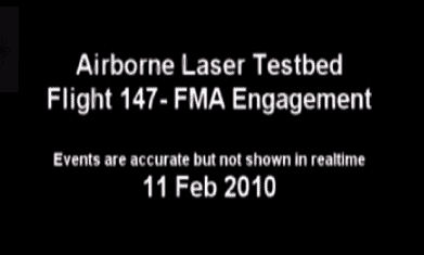
The above video is of the YAL-7. Notice at the beginning it shows it firing the weapon. This is seen from an infrared camera. Once again, from this particular plane the laser cannot be seen. I can’t stress that enough. In the day and age of Photoshop CGI, nothing can be trusted without first hand confirmation and verification. That’s why I question a lot of those images.
Satellites and Lasers
I have already mentioned the use of drones and planes when it comes to DEW lasers. It is very plausible, but in my opinion, unlikely. I’m not saying they didn’t do it that way but I have a gut feeling that Elon Musk’s Falcon rockets that they are launching LEO satellite’s may be a better theory. I honestly think this could be how lasers along with Smart Meters are able to hit sites with pin point accuracy. I mentioned above how these lasers can also only be seen using infrared cameras. I guess if you want to use a giant red or green laser, then the psychological factor is definitely there. But, you would think more people would see giant laser beams hitting houses, buildings and roads as was not the case with Paradise.
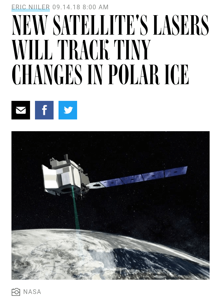
I came across an article a few weeks ago about satellite’s projecting lasers to earth in order to study the sea ice. Now I’m only showing you this to give you an idea on what a laser can actually do. Let me show you what they say. (Italics are my comments)
“For almost a decade, NASA hasn’t had a satellite watching the planet’s melting sea ice. That’s slated to change with tomorrow’s planned launch of the $1 billion ICESat-2 satellite from Vandenberg Air Force Base, in California. Once it settles into orbit 310 miles above the Earth, the satellite will start collecting data using a specially designed laser device that will give scientists more data about exactly where ice is melting and how fast. (Notice that the article came out 9/14/18 and that this particular satellite was launched the next day in Vandenberg.)

The NASA satellite will scan the Earth’s surface using six green laser beams to measure glaciers and floating sea ice. By taking precise measurements of the ice thickness and mass, NASA scientists will get a handle on the effects of climate change more accurately, researchers say.
“We are trying to understand the processes and drivers that are behind this change and do a better job with forecasts of sea level rise,” said Tom Wagner, cryosphere program scientist at NASA Headquarters in Washington. (This particular satellite uses 6 lasers to scan the ice.)
Each laser bounces 10,000 times a second down to Earth’s surface and back. A 31-inch wide beryllium telescope on the satellite captures the returning light beams and sends them into an electronic signal detector that figures out the distance to Earth. The six beams cover a six-kilometer-wide (3.7 miles) strip across the Earth, measuring everything in its path (the lasers are harmless to people, plants and ice)…The 3,341-pound satellite is a long-awaited replacement for the original ICESat, which ended its one-laser mission in 2009…Its on-board instrument, known as ATLAS (Advanced Topographic Laser Altimeter System), acts like a stopwatch, firing photons that take 3.3 milliseconds to travel down to Earth and back.” (https://www-wired-com.cdn.ampproject.org/v/s/www.wired.com/story/new-nasa-satellites-lasers-will-track-tiny-changes-in-polar-ice/amp?amp_js_v=a2&_gsa=1&usqp=mq331AQHCAFYAYABAQ%3D%3D#referrer=https%3A%2F%2Fwww.google.com&_tf=From%20%251%24s&share=https%3A%2F%2Fwww.wired.com%2Fstory%2Fnew-nasa-satellites-lasers-will-track-tiny-changes-in-polar-ice%2F)

Now each these 6 lasers
“bounces 10,000 times a second down to Earth’s surface and back. The six beams cover a six-kilometer-wide (3.7 miles) strip across the Earth, measuring everything in its path (the lasers are harmless to people, plants and ice).”
So did you catch that? Remember, I’m just referencing this article on a satellite laser so you can get an idea of what a laser can actually do. It can bounce 10k a second to the earths surface and back to the satellite. Do you realize how fast that is? And I bet you can’t see the laser with the naked eye. The 6 lasers cover 3 and a half mile wide areas. If one of these satellites, hypothetically speaking, carried a DEW, than it would literally take seconds to destroy a town like Paradise that is probably no more than six to seven miles wide. Could you see how a satellite laser is theoretically more plausible than say a YAL-1 747?

I’m just saying this. If DEW was coming from a satellite then you wouldn’t even know what hit you until you were already on fire. Remember, people in Paradise jumped out of their cars to get away from the fire. It came upon them that fast. And…there were no eyewitness accounts of anyone actually seeing a laser with the naked eye. But I guarantee you, they were there.
Some Trees Were Saved
They are calling it a “Christmas miracle”. I think its interesting that the Christmas tree lot actually survived. It looks like it didn’t do the DEW. No matter how you look at a Christmas tree, whether you think it represents a phallus or a tree of life or whatever, it is a trip that this is what survived in Paradise. The “tree of life” or “phallus of Osiris” still standing in “Paradise”. You can decide where you’ll go with this story.
“One might be surprised to find the hundreds of Christmas trees still standing since the Camp Fire swept through the town of Paradise – some might call it a Christmas miracle. Although the structures surrounding it are destroyed, the Christmas trees are still there. He’ll miss growing things, and greeting all the families who pick out their Christmas tree from his farm, especially on the day after Thanksgiving. Traditions dying, buried under the debris. But miraculously the trees still standing, waiting for residents to return home. A symbol of hope that the Paradise still has life despite all the devastation.” (https://krcrtv.com/news/camp-fire/a-christmas-miracle-christmas-tree-farm-in-paradise-still-flourishing-after-camp-fire)
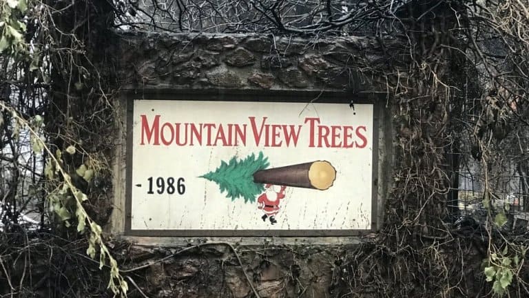
And it actually may not be a “miracle”. PG&E were the “miracle workers” in this case. “Joe McNally, the owner of Mountain View Tree Farm, says,
“I want to have a house here that I can live in. You know I don’t want this to be all like Santa Rosa.”
His Christmas Tree Farm lies on a big chunk of land where PG&E is completing this project. Removing the vegetation started in June and PG&E hopes it will be completed by the end of November.” (https://krcrtv.com/news/local/pge-funding-50000-project-in-paradise-to-prevent-wildfire)
I wonder if it’s a miracle that we as tax payers in California will now have to pay more on our PG&E bills because of this destruction?

The White House released the pictured from Melania decorating for Christmas. Twitter went crazy calling them blood red trees.


I was thinking it fits their red wave paradigm of “sacrifice”. It’s interesting that these trees look like they are on FIRE. 


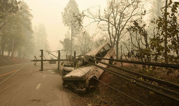
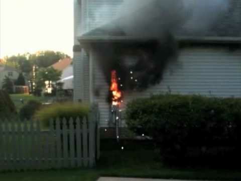
I will leave you with this. The first photo is from last night where I live. That was a real house fire. Notice the blackened wood, walls down and roof intact.
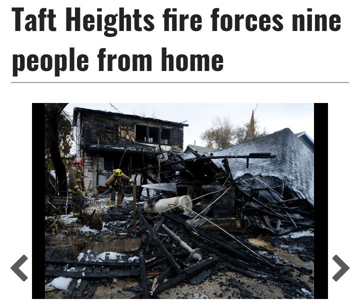
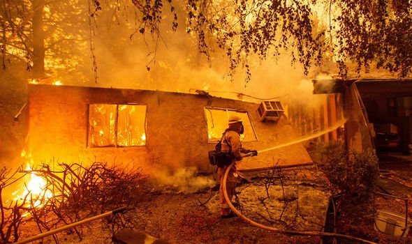
The second photo is not a real house fire. More like an explosion from above. The walls are still standing.
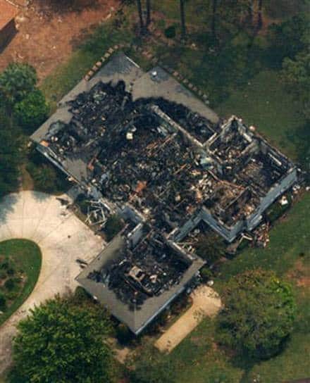
The third image is also not from a real house fire. You can see how everything was turned to grey ash due to the violent heat.
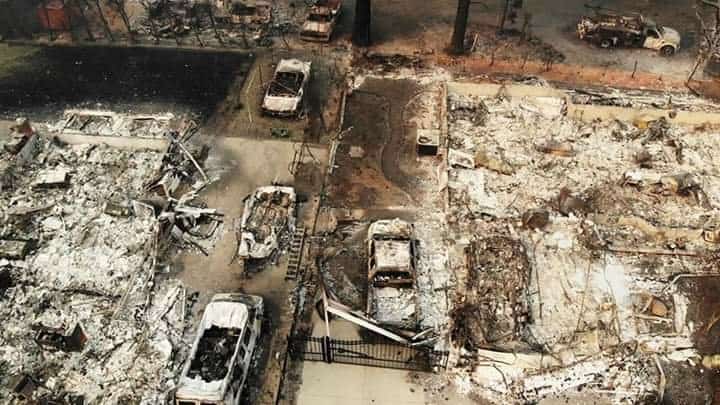
These are three images of houses, one by a natural ground fire, one from DEW and the last one from dew and smart meters.
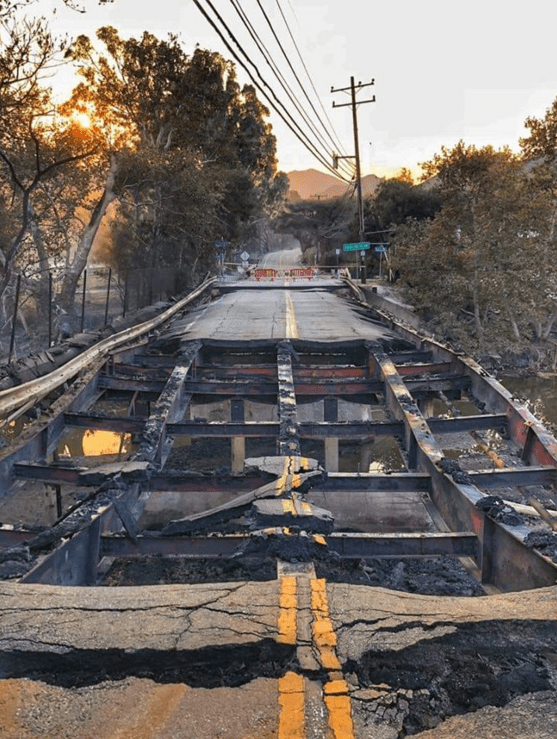
And how hot does it need to be to “burn” a bridge?